
Potatoes were not native to Ireland or, for that
matter, to Europe. They were introduced to Europeans in the 16th
century by Spaniards returning from Peru where they were a staple of
the Incan diet. The English explorer Sir Walter Raleigh is thought to
have brought the first potatoes to Ireland to his estate in west Cork
in the latter part of 1500s. The crop was not met initially with favor
as food in either Ireland or Europe in general. In fact, its primary
use for over a century was as feed for stock and, to a lesser extent,
as food for the poor. By the late 17th century, though, they had
gained more acceptance in part because of shortages of other staples
and in part because they were so easily cultivated. By 1850 potatoes
constituted a significant portion of agricultural acreage in Ireland
and, for the poor especially, up to 60% of the daily diet.1
Potato blight began to infest the Irish crop in 1845 and continued for
the better part of a decade resulting in a dramatic transformation of
the Irish population by death from starvation, by disease, and by
emigration - particularly to the United States and Canada. In this
unit you will explore the physical and social effects of the blight on
the Irish population, efforts to provide relief, the emigration out of
Ireland as a result of the famine, and the immigration of Irish into
the United States
The Quaker Church in England was among the first private institutions to realize the seriousness of the potato famine in Ireland and to engage in trying to deal with the catastrophe. The following activity will introduce you to the devastating impact of the blight, to the geography of Ireland, and to several social and historical issues that compounded the decade long tragedy - issues that you will study in more detail in later lessons.
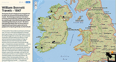
Click on the map above to open a story map. It leads you in a trip through Ireland in 1847 through the eyes of William Bennett, a London Friend, whose travel goals were to assess the situation in Ireland for his church and to distribute limited amounts of vegetable seed, money, and clothing to those in need. The letters he wrote home were published shortly after his return to England along with his conclusions about the Irish situation. Several of these letters are excerpted in the map journal. Click on the map to begin your trip. As you read through Bennett's letters pay particular attention to the author's observations about:
- the individuals he meets from various social classes,
- the geography he encounters,
- the potential for agriculture in the places visited, and
- the ways in which different individuals, groups, and government agencies were trying to meet the needs of the starving
1) In his conclusion, Bennett describes a geographic division of
Ireland in terms of the extreme effects of the famine. Briefly
describe this division and make a sketch of Ireland showing it.
2) On the road to Sligo Bennett writes that "the strength of the country is departing." Briefly explain what it was he was describing.
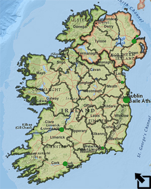
3) Bennett obviously has an eye on the physical character of the
Irish landscape. Open the Irish Famine map at the right and zoom in on the various
mountainous regions in Ireland. How high are the five highest
mountains you find? Compare your results with classmates and come to
an agreement about which five mountains are the highest.
4) Bennett describes a variety of forms of famine relief in his
letters. List and briefly describe as many as you can identifying who
was responsible for each.
5) During the years of the famine tenant-landlord relationships played a significant role in the lives of the Irish. Compare and contrast at least two different types of landlord behaviors that Bennett encountered in his travels.
6) Zoom in on the Irish Cities layer in the Irish Famine map and explore the region surrounding each
city. What physical geographic characteristic(s) do most of these
cities share?
7) The Irish Cities layer shows the relative
populations of several Irish cities in 1841 and 1851. Select to Show
Table and arrange the cities in ascending order of
population in 1851. What do you notice about the populations of the
cities comparing the 1851 populations with those from 1841?
8) Turn on the Irish Famine layer to show the counties of Ireland. Examine the counties in relation to various aspects of the physical geography of the country (rivers, mountains, etc.). Describe which counties you think would be generally most favorable to agriculture. Explain your choices.
1John Crowley, William J. Smyth, & Mike Murphy, editors. Atlas of the Great Irish Famine. New York: New York University Press, 2012.
Last modified in October, 2021 by Rick Thomas